
.png)
.png)
.png)
.png)


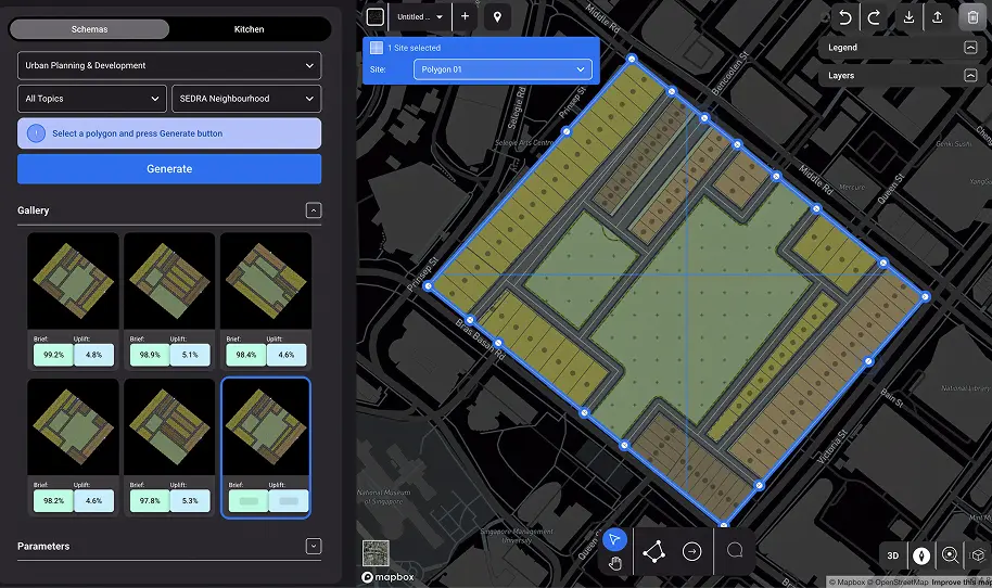
What is Mplot?
MPlot solves complex masterplanning challenges during the exploration and design phase of a project.
We use GIS-based planning and AI to help cities, consultants, architects, planners and developers to instantly generate scenarios, validate designs with real-time analytics, and reduce rework.
.webp)


.webp)

.webp)
.png)
.png)
.png)
.png)


